SERCAL 2026 Fieldtrips
The glorious details for these fieldtrips are still being fleshed out, but here’s a taste to whet your appetite!
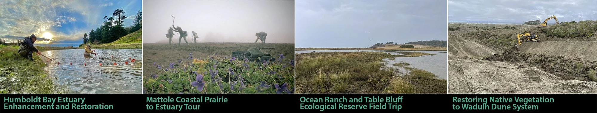
Humboldt Bay Estuary | Mattole Coastal Prairie to Estuary | Ocean Ranch and Table Bluff | Restoring Native Vegetation to Wadulh Dune System
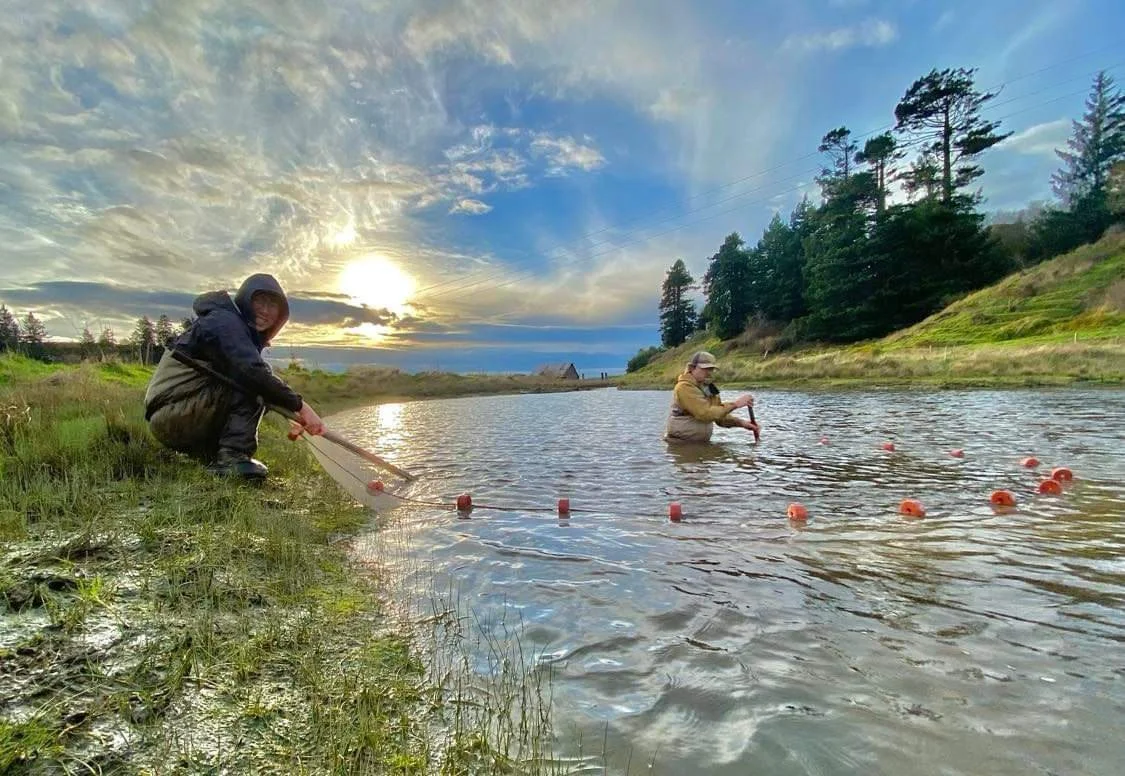
Humboldt Bay Estuary Enhancement and Restoration
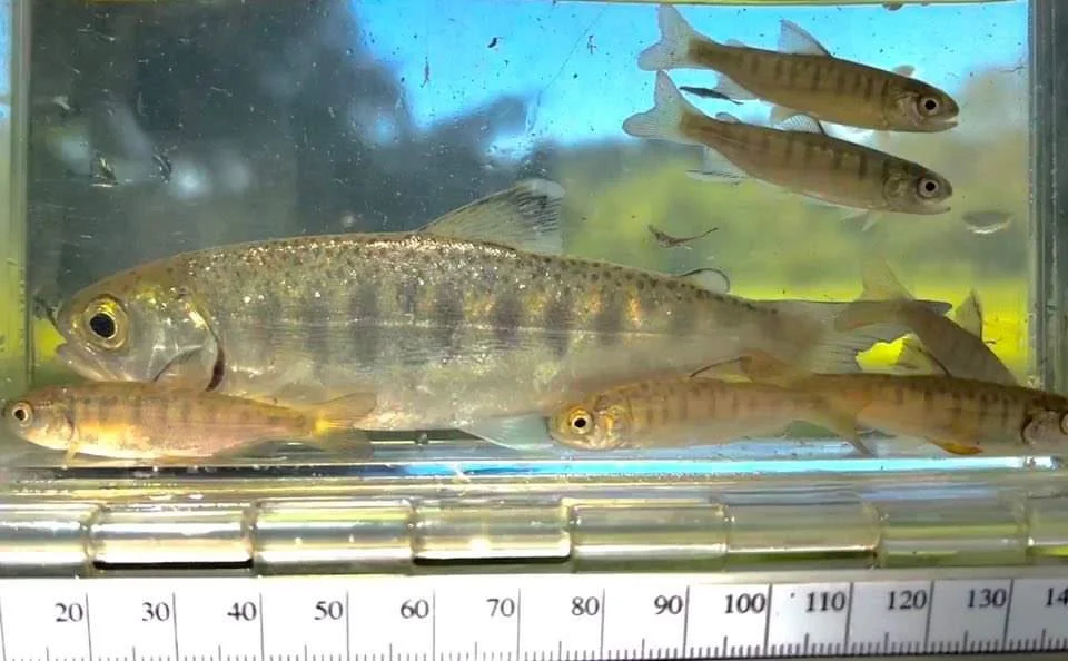
Visit completed, ongoing, and future estuary enhancement project sites around Humboldt Bay. These projects address sea level resiliency, invasive plant removal, restored tidal function and salt marsh, and improved fish and waterfowl habitat.
Led by: Ross Taylor, Ross Taylor and Associates; Kate Gazzo, North Coast Regional Land Trust; Mark Bowen, Thomas Gast and Associates Environmental Consultants; Michael McDowall, City of Arcata; Michael Love, Michael Love and Associates; Kristin Schmidt, Redwood Community Action Agency; Katy Gurin, California Trout; and Katie Marsolan, City of Eureka
8:30am departure from River Lodge in Fortuna — return at 4:00pm
Itinerary: McDaniel Slough and Janes Creek >> Wood Creek, including Felt Ranch phase >> Lunch Break at Freshwater Farm or Muni Golf Course patio >> Martin Slough, including muted tide gate >> Lower Elk River – two sites, east and west of Highway 101
Mattole Coastal Prairie to Estuary
The Mattole Restoration Council is one of North America’s oldest community-led watershed restoration organizations. Established in 1983, the Council’s primary mission is to understand, restore and conserve the ecosystems of the Mattole River watershed, with attention to threatened coho and Chinook salmon and steelhead. Established in 1980 by Mattole Watershed residents determined to improve and restore the remnant runs of native Mattole salmon, the Mattole Salmon Group was one of the first-citizen led watershed restoration organizations on the West Coast.
Led by: Mattole Restoration Council and Mattole Salmon Group
Morning departure from River Lodge in Fortuna — return in afternoon.
Itinerary: Start at Mattole Native Plant Nursery, drive to view of Mattole Estuary in-stream and slough restoration, then drive up to the top of Kings Range overlooking the ocean to catch a possible glimpse of a super bloom post prairie restoration, invasive species management, prescribed burn, pile burn, and community wildfire defense projects.
Travel to the site is about an hour on windy roads, good to have AWD/4WD and full gas tanks.
The goal of the Mattole Restoration Council’s Ecosystem Restoration Program is to promote healthy and productive native ecosystems including grasslands, oak woodlands, riparian corridors, wetlands, and forests.
Ocean Ranch and Table Bluff Ecological Reserve Fieldtrip
Tour Ocean Ranch Restoration Project and Table Bluff Ecological Reserve Coastal Prairie Restoration Project with California Department of Fish and Wildlife, Mattole Restoration Council, and the Wiyot Tribe.
Led by: Kelsey McDonald, James Ray, and Mike van Hattem, CDFW; Christina Cortez, Mattole Restoration Council; and Adam Canter, Wiyot Tribe Natural Resources Department
Morning departure from River Lodge in Fortuna — return in afternoon
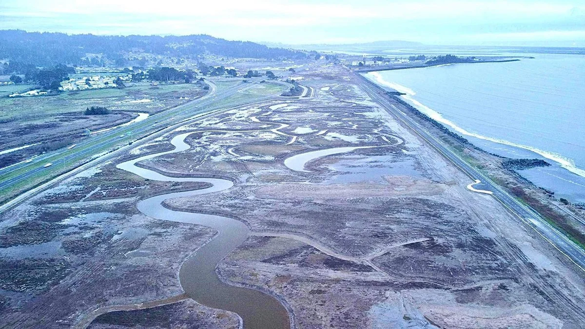
Bring your binos (or hand lens if you are of the botanical persuasion) and sturdy closed-toe shoes for a walking tour of coastal restoration projects on CDFW's Ocean Ranch Unit of the Eel River Wildlife Area and Table Bluff Ecological Reserve. The Ocean Ranch Restoration Project included restoring full tidal influence, recontouring land behind failing levees, and installing large wood to improve habitat for juvenile salmonids and other estuarine species. Additionally, the Ocean Ranch Restoration Project encompasses 219 acres of coastal dunes invaded by European beachgrass (Ammophila arenaria) and 193 acres of salt marsh invaded by dense-flowered cordgrass (Spartina densiflora). Native dune mat and salt marsh communities support many rare plant species. Restoration of these highly invaded plant communities at the Ocean Ranch Unit consists of removal of invasive plants using Integrated Pest Management that includes application of herbicide, prescribed fire, mechanical grinding, and manual pulling, with passive recolonization by native species. While the initial dune treatment area has successfully achieved and maintained ~1 percent cover of invasive European beachgrass, and tidal restoration has been highly successful in providing habitat for salmonids and other wildlife, removal of dense-flowered cordgrass has encountered more challenges. See our success, areas of restoration in progress, and hear about lessons learned at Ocean Ranch.
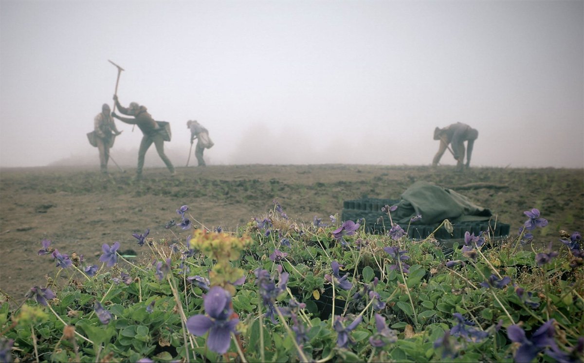
After lunch, we will head up the hill to the adjacent Table Bluff Ecological Reserve, which supports a population of federally and state endangered western lily (Lilium occidentale) and native coastal prairie and scrub habitats with many species that are culturally significant to the Wiyot people. Western lily, the coastal prairie plant community, and the culturally significant plants found there thrive in early successional habitats that have been squeezed between extreme human disturbance from agriculture and development, and conifer encroachment in areas where disturbances have been suppressed. CDFW has partnered with the Wiyot Tribe and Mattole Restoration Council to implement recommendations for western lily recovery from the U.S. Fish and Wildlife Service, conduct an experimental pilot project to test coastal prairie restoration techniques, restore the degraded pasture based on experimental results and Traditional Ecological Knowledge (TEK). Following the removal of encroaching native conifers from western lily habitat in 2023 and reinstating seasonal grazing, the reproductive population increased 324% from 98 pre-project in 2022 to 416 in 2025. We will discuss the ongoing habitat restoration to benefit western lily and tour the experimental pilot project area to determine the most successful methods and species to use in restoring culturally significant coastal prairie vegetation in degraded pasture.
Dress for variable weather, including wind, rain, and sun, and wear sturdy walking shoes or boots acceptable for sand, rocks, and mud. Bathrooms (pit toilets) are available at the nearby county park, and we can coordinate carpooling for bathroom breaks as needed. We will coordinate some 4wd carpooling between sites if requested.
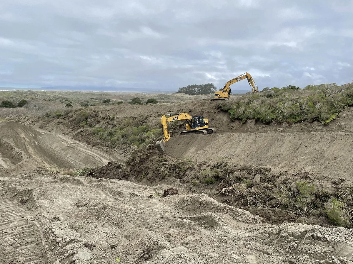
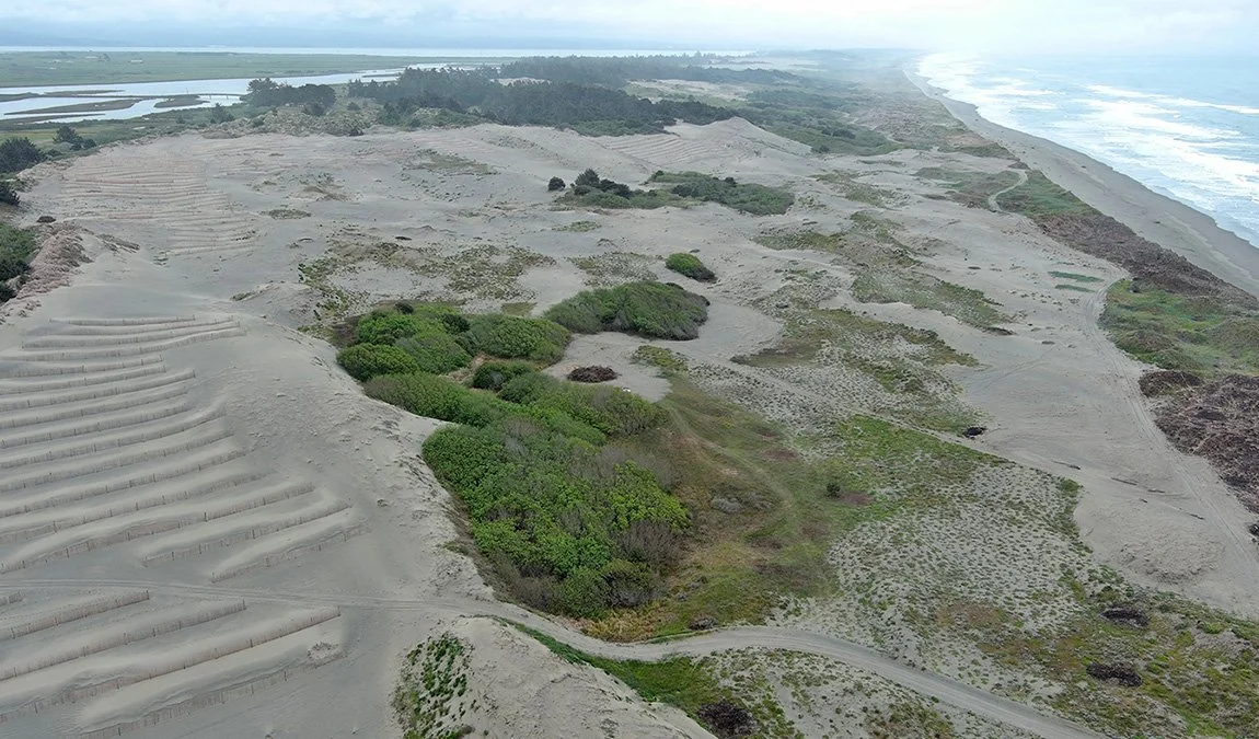
A Dune System Rejuvenated
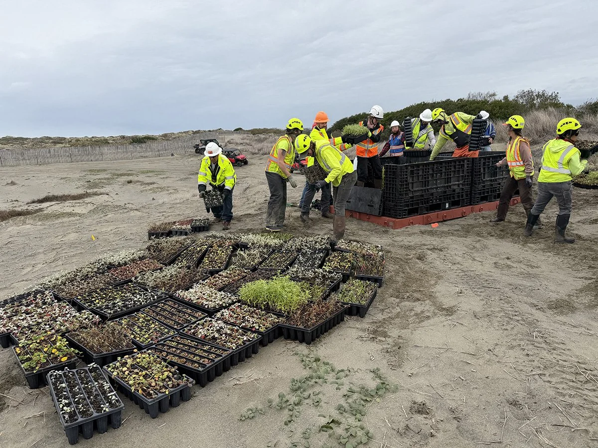
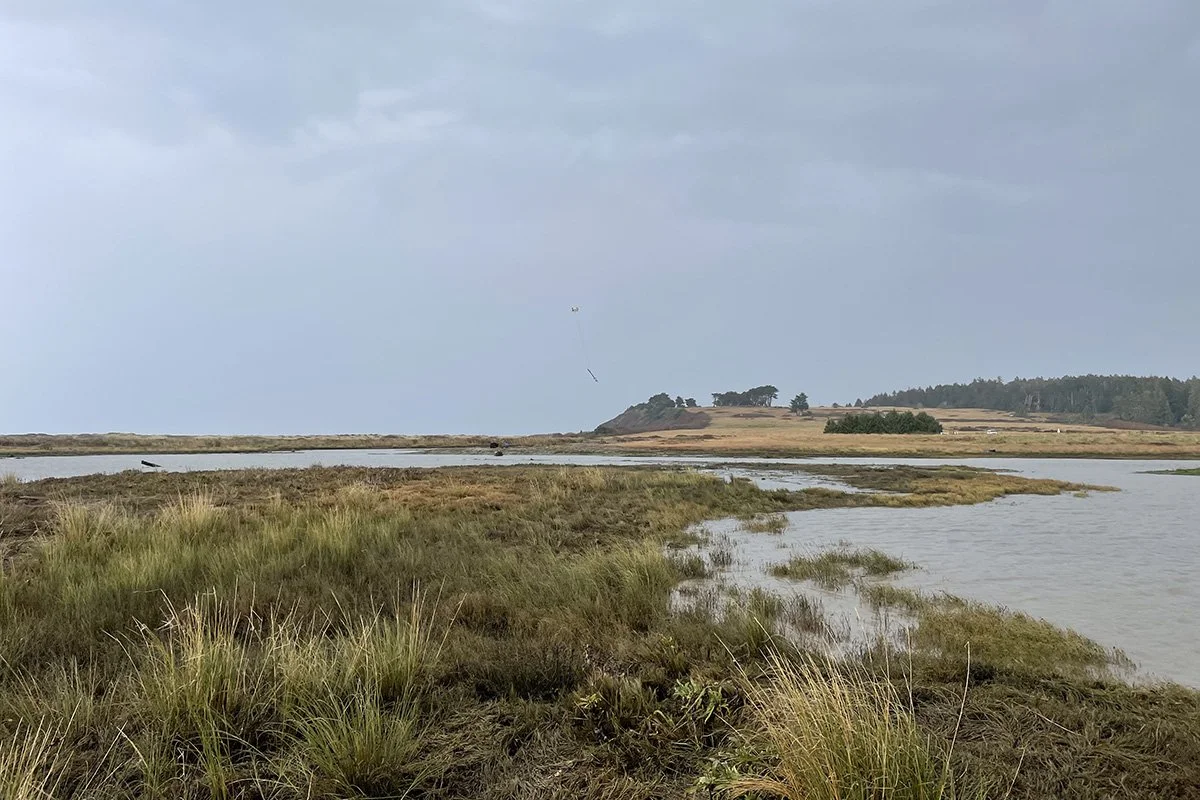
The 200-ac Wadulh dune system in Humboldt Bay NWR was severely invaded by yellow bush lupine, European beachgrass, and invasive annual grasses. The goal is to restore underlying geomorphic processes and biodiversity, returning the site to an early successional environment. Techniques being used include heavy equipment, manual removal, herbicide application, a prescribed burn, and propane torch flaming. Sand fencing was installed to provide short-term stability for revegetation. 277,000 nursery grown plants were transported by helicopter and planted by crews. Inoculant collected from under native dune vegetation at the nearby Lanphere Dunes was placed in planting holes. Monitoring of morphodynamics, vegetation cover, and survival is ongoing. The drive from Fortuna to the site is about 45 minutes each way. We will be walking 3+ miles, including hilly terrain and soft sand. The entire field trip with travel time to and from Fortuna will be 4-4.5 hours.
Led by: Jillian Zimmerman, Nicole Matonak, and Andrea Pickart, USFWS.
Take a gorgeous walk on the dunes during peak wildflower season to see a first-of-its-kind, 200-acre dune restoration project at the Wadulh (pronounced wa-DUSH) Unit of Humboldt Bay NWR. We will start with a short but hilly walk through forested dunes, emerging on to a 1,700-foot-long partially vegetated “parabolic” dune. We will then traverse through an area once solidly vegetated with yellow bush lupine and other invasive vegetation, which has been restored through the removal of invasives and underlying organic “duff” using heavy equipment to allow native plants to return. Equipment operators worked delicately to retain the original dune morphology. The next stretch takes us through an open area of native vegetation where the endangered Menzies’ wallflower may still be in bloom. After heading west, we’ll walk north behind the foredune through colorful blooming Dune mat, and along seasonal, ground water-fed willow/beach pine “swales.” A climb up a high dune offers expansive views and a look at the dune forest. Next, a loop will take us around a large, cleared area previously vegetated with dense invasive lupine and European beachgrass. We’ll walk through 40 acres of revegetated dunes, some with short-term sand fencing to reduce mortality in this unstable environment. After arriving at the “forest island” (a surviving peninsula of the mostly buried forest where spruce tower over the open dunes), we will stop for lunch. Next, we’ll walk along the foredune and continue with views of the ocean. Here we’ll see acres of revegetated foredune, previously sprayed and burned, then planted with American dunegrass.
The total walk is about 3 miles, but remember you’ll be walking on soft sand, and dunes are hilly. A porta-pot will be available at the beginning and end of the walk. Bring plenty of water, a lunch, and sunscreen. Don’t forget your camera, as you will want to record the scenery. Weather can be very windy in May (after all, dunes need wind to form), so bring a windbreaker. Rain is possible but not probable. Wear layers, including a waterproof layer if rain is predicted. Soft-soled shoes or light boots are best since we will be walking near sensitive habitats. Carpooling is required as parking is limited. Drive 10 mph as you pass the farmhouses at the beginning of Lanphere Road. Someone will direct you from the end or the road to parking. so please carpool from Riverside Lodge.
In May the weather can be extremely windy. Rain is possible but not probable. Wear layers, including a waterproof layer if rain is predicted. Soft-soled shoes are best for the dunes but light boots are okay. Carpooling is required as parking is limited — carpools will meet at the River Lodge. Details directions (driving, when to meet, etc.) will be given to all participants closer to the conference.